Golden Penny Magazine
comad September 24th, 2014
The Golden Penny
27th June 1903
“An Illustrated Home Weekly of stories, adventures, yarns, sport, humour and inventions”
THE GREAT MOTOR RACE OVER THE GORDON-BENNETT COURSE.
By Lilian E Bland
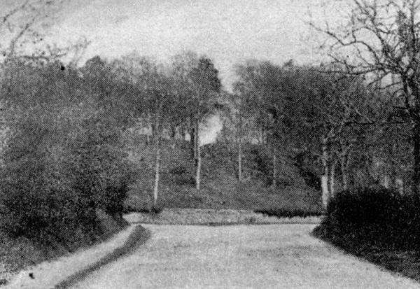
WHERE THE AUTOMOBILE CLUB WILL HAVE THEIR GRANDSTAND
AT ARDSCUL
Next Thursday will witness the great international motor race for the Gordon-Bennett Cup. The race, which, as everybody knows, is to take place upon the chosen course in Ireland, is to commence at 7 a.m., and will in all probability finish about 4 p.m. The course is 351 miles in length, and the cars, which are expected at certain points to reach a speed of nearly ninety miles an hour, will start at Ballyshannon Cross Roads, [1] near Naas, proceeding by a circuitous route via Carlow, Athy, Maryborough, Kildare, and the Curragh. Last year the race took place in France, and was won by Mr.F.S. Edge, [2] who, as holder of the cup, was entitled to choose the venue of the present year’s race.
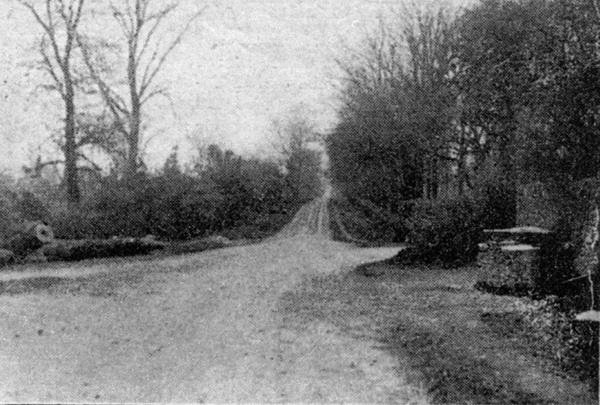
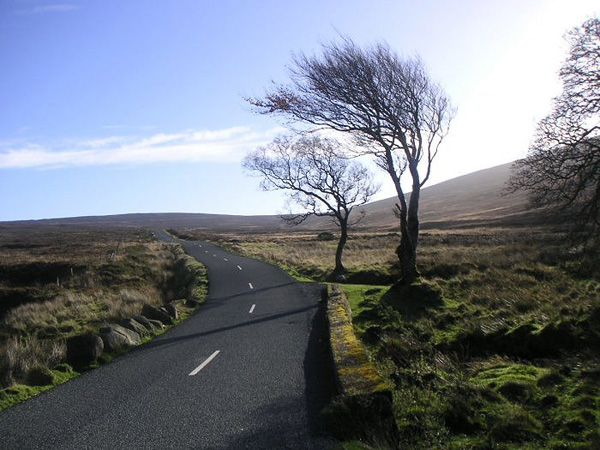
BALLYSHANNON CROSS-ROADS
WHERE THE RACE WILL START AND FINISH
THE COURSE AND ITS LEGENDS.
Apart from the interest to motorists in the Gordon-Bennett road as a racing track, the counties through which it will be run abound in interesting ruins and old legends. The Moat of Ardscull, [3] which is not far from Ballyshannon Cross (where the cars will start) is an ancient fortress. Ardscull means “The Hill of Shouts,” and was the scene of many battles; now it is frequented by the “little people” and a headless ghost!
It is not often one hears of a man cutting his own head off, yet such was the sad fact. Two labourers were walking along the river, when they saw a fine salmon hiding his head, ostrich fashion, under the bank. The temptation was too great, and Pat leant over and made a stab at the salmon with the butt end of his scythe, quite forgetting that the blade was over his shoulder, and to his comrade’s horror, off went Pat’s head, floating down the stream accompanied by one of his own ears! The poor man, so the natives will tell you, is still searching for his head, but probably the motor cars will effectually frighten all ghosts away. The Moat will be open to the public and it is one of the best places from which to see the race.
AN INTERESTING SPOT
Old Kilcullen [4] is the next place of interest.
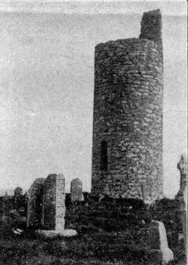
THE ROUND TOWER AT OLD KILCULLEN
Near the round tower the road turns sharply to the right. “Kilcullen” is Irish for “The Church of the Holly”. In olden days it was a prosperous walled town, before the bridge was built over the Liffey. [5] These round towers date from the ninth to the thirteenth century, and were used as strongholds for the priests in cases of sudden attack. They also used them as watch towers and beacons. In the photograph will be seen part of the stone cross sculptured with scriptural subjects. In 1798 the graveyard was the scene of a fierce battle between General Dundas [6] and the rebels, who fought with pikes and repulsed Dundas’s force. Beyond Old Kilcullen the road is good to Castledermot [7] which is noted for its round tower and ruined monastery. Into Carlow the road is uninteresting, and then comes Mageney Bridge – a sharp double turn over the River Barrow.
THE SHARP TURN AT MAGENY BRIDGE
Athy [8] is soon reached, and built on the bridge is an old castle of the Fitzgeralds.
SOFT LANDING.
The cars now go over the same road put Ardscull Moat and on to “new” Kilcullen. Here they have a sharp left-handed turn round an uncomfortable stone wall, which brings them into the road to the Curragh, Kildare, Monasterevin, etc.
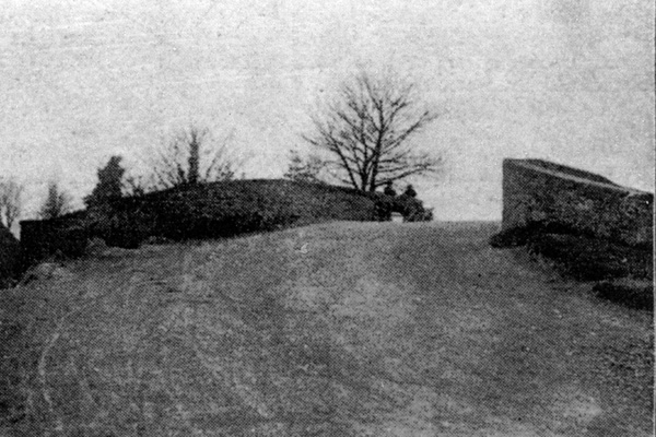
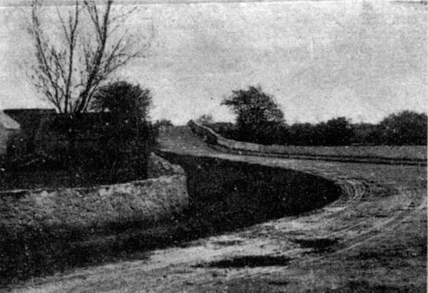
THE CANAL BRIDGE AT MONASTEREVIN
A short way out of Monasterevin they cross the canal bridge, which will require some nice steering, but, as Paddy remarked, ” Shure the wather will be soft landing for thim.” However, having, we hope, safely negotiated this obstacle, they have a good road on to Ballybrittas – a straight nine miles stretch, passing the Great Heath of Maryborough on the left, two more left handed turns, and then a run over the bog road passing close to the Rock of Dunamase [9] (‘The Fort of the Plain ’)
In ancient times this was the castle of the O’Mores . [10]
Many quaint legends are connected with this historic place, which want of space compels us to omit. A splendid view will be obtained from The Rock and Grange Hill. The road now descends into Stradbally, [11] and winds up the opposite hill to the Windy Gap. Further on the road becomes narrower and winding. A sharp turn to the left brings them on to Ballylynan, and from there it is a grand road to Athy, where the motors commence the same course again.
Notes:
1.
1. The race started at the Ballyshannon cross-roads
near Calverstown, which is 53km southwest of Dublin. (53.086580N 6.817069W )
2. Selwyn Edge – Paris-Innsbruck 1902:
The Gordon Bennett cup race was one of the most important racing fixtures of 1902. It was run on public roads between Paris, France, and Innsbruck, Austria. The route featured a 312 km neutralised section to take the competitors through Switzerland, where racing was banned, which was not counted as part of the overall race distance. The roads in Switzerland were not as smooth as in France, and this put considerable strain on the cars despite the national speed limit of 15 mph. Six cars were entered in the race. One retired and four had mechanical problems. Selwyn Edge driving a Napier, and representing the Automobile Club of Britain and Ireland, finished the 565 km race in just over eleven hours, and was the only competitor to finish. So Britain were the winners of the Gordon Bennett Cup.
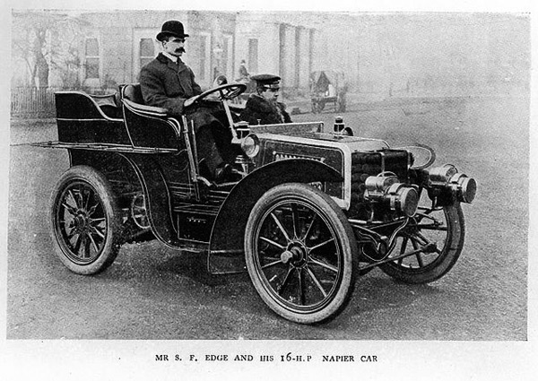
Mr S. F. Edge and his 16HP Napier Car
photo by Richard – Flickr – Wikimedia
3. The Moat of Ardscull is the remains of an Anglo-Norman Motte and Bailey timber castle. It is situated in a commanding position, on the main Kilcullen to Athy road, affording extensive views in all directions. The Moat is a large oval-shaped mound, surrounded by a ditch and bank. The entrance was on the west where there is an opening through the upper bank and a causeway across the ditch. The ditch is between 6 and 7m wide and the external bank is 10m wide. Originally the mound would have supported a high wooden tower, the bank would have been topped by a wooden stockade, the entrance causeway would have had a substantial wooden gate and an enclosed area, known as the Bailey would have, contained the house and outbuildings of the resident lord and his family and retainers. – Kildare Community Network information.
4. Old Kilcullen:
Kilcullen and K-Bridge, Taylor and Skinner – Wikimedia
5. The River Liffey rises in Sally Gap (53.1376N 6.312W) which is the east-to-west passage that runs through the Wicklow Mountains.
Sally Gap by Maryam Al Saeed
The Liffey then travels one hundred and twenty five kilometres finishing its journey through the centre of Dublin City, out into Dublin Bay, and to the Irish Sea. In 1939, Liffey and King’s River valleys were flooded to facilitate the Poulaphouca dam, creating the Blessington Lakes. The resulting lakes extend over approximately 5,000 acres (20 km²). A small village was submerged by the damming of the waterfall, and the remains of roads can still be seen leading down into the lake.
The Leinster Leader’s West Wicklow notes correspondent was among the first to record the beginning of work in an issue of November 1937: ‘The erstwhile lonely, silent conditions at Poulaphuca waterfall have suddenly been displaced with extraordinary hum and activity. Fifty men have already started work on the scheme. Houses, including a new Garda station, are springing up rapidly and before long the entire district included in the scheme will see a little army of workers employed there.’
The main contract for the massive dam construction work had been awarded to the Francois Cementation company, based in Doncaster, England. The company had patented a method of sealing porous stone against water seepage. Their contract was for the construction of the dams, tunnels, and structures at both the Poulaphuca dam, and the smaller Golden Falls dam. Employment on the scheme grew spectacularly at Poulaphuca as the construction tempo accelerated. From the fifty workmen who had moved on site in November 1937 the workforce had grown to 200 by July 1938. An Irish Times reporter who visited the site in February 1939 wrote ‘High up on the rock face, drills were preparing for fresh charges of gelignite and when I was in the neighbourhood I heard several explosions. Near the face of the dam the tunnel which will carry the water to the power-house is being bored.’
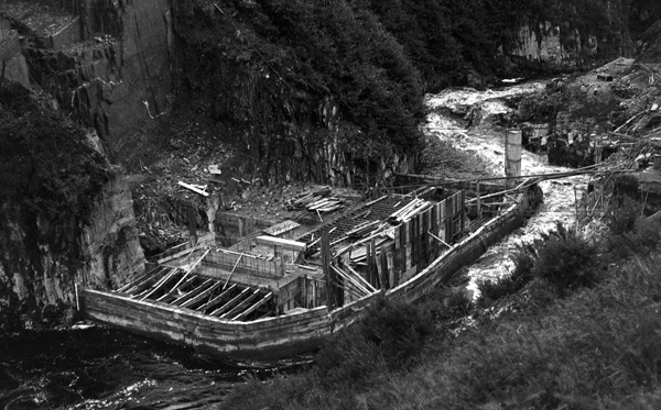
Construction of the Poulaphuca dam
“The Púca’s Hole” – James P O’Dea – 1st January 1938
National Library of Ireland
By that time 12,000 tons of concrete had been poured into the dam; the same quantity again would be required to complete it.
By March 1940 all was in readiness to begin flooding. The dam had been completed; and some 5,500 acres of the Liffey valley between Blessington, Lacken and Valleymount had been vacated by man and beast and all was now ready for flooding the valley. The sluice gate was dropped on the river flow at 10am on 3rd March 1940. The mountain waters of the Liffey began to pool behind the dam, and by September the Poulaphuca lakes were there for all to admire.
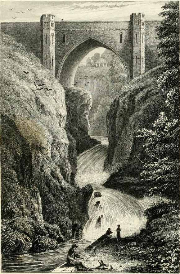
“Poulaphouca waterfall” in 1833 – Wikimedia
“The cataract is formed by the descent of the River Liffey through a narrow opening in a craggy precipice, falling from a height of upwards of one hundred and eighty feet, over several progressive ledges of rocks, till it is precipitated into a dark abyss, where it forms a whirlpool of frightful appearance and immense depth. Owing to the manner in which the water is broken in its descent, Poul-a-Phouca is by many considered the most picturesque fall in the county of Wicklow. A handsome bridge, of a single Gothic arch, has been thrown across the chasm through which the water rushes. The span of this arch is sixty-five feet, and its key-stone is one hundred and eighty feet above the level of the river. On one side, the glen for some distance, both above and below the fall, is overhung by abrupt and naked rocks; on the other, the banks being less precipitous are cut into walks, and otherwise tastefully embellished. This is a portion of the demesne of the Earl of Miltown, whose splendid mansion of Russborough, at a short distance from the fall, is the most conspicuous ornament of this part of the county. In the fairy mythology of Ireland the ‘Phouca’ or ‘Pooka’ is described as a mis-shapen imp, haunting lonely glens and dark recesses; he resembles in his habits and disposition the Scotch Brownie and the Scandinavian Troll.”
– The Scenery and Antiquities of Ireland 1841 J. Stirling Coyne & N. P. Willis
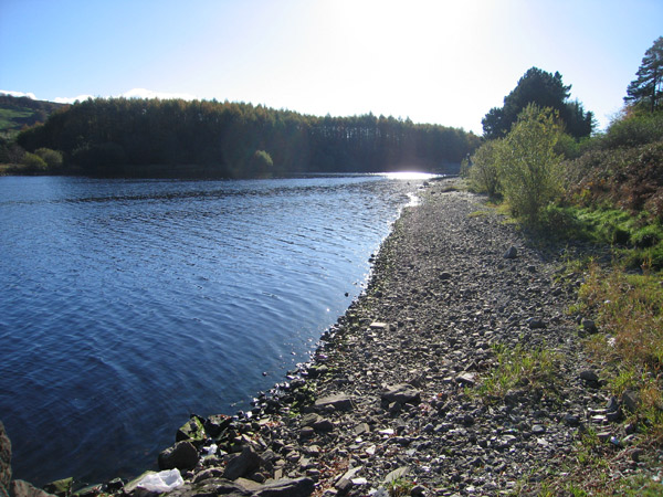
” Poulaphouca Reservoir, County Kildare ” by sarah777 – Wikimedia
6. The Battle of Kilcullen took place on 24 May 1798 near the two settlements of that name in County Kildare, and was one of the first engagements in the Irish Rebellion of 1798. Lieutenant General Ralph Dundas, Commander of the Army of the Midlands, whose headquarters, Castle Martin, was located only three miles away, quickly mustered a combined force of about 120 infantry, cavalry and dragoons and marched to disperse the rebel gathering.
The 80 or so cavalry and dragoons raced ahead of the infantry and upon arrival at the base of the hill, charged the rebel gathering. The rebels however, quickly entrenched themselves on three sides by using a ditch and the walls of the ruined church to protect their flanks. The cavalry were driven back by the long pikes of the rebels, losing over thirty of their number and many of their horses in the fighting. Two of their captains lay dead on the field.
The rebels threatened to take advantage of the disarray of the cavalry with their own attack, but the eventual arrival of Dundas’s infantry protected the cavalry survivors and allowed them to withdraw to Kilcullen Bridge, where they were reinforced by about 100 local yeomen.
As news of the Government defeat spread through Kilcullen and the surrounding area, the rebel army swelled with recruits until it numbered almost 1,000 men. The rebel leadership then decided to quickly follow up their victory by cutting off the remaining garrison from the Dublin Road thereby cutting communications between Dublin and the south. The rebels forded the river Liffey downstream from Kilcullen Bridge and occupied the high ground on both sides of the road at Turnpike Hill.
General Dundas, by now no longer underestimating his opponents, devised a ruse to draw the rebels down from the high ground by sending a small party of cavalry ahead, their orders were to avoid combat and lure the rebels into prepared lines of fire. The rebels took the bait and chased after the advance party only to be hit by several musket volleys from the waiting soldiers. When the rebels reached the Liffey in disarray, the cavalry were unleashed and scattered them, killing about 150 for no reported losses on the Government side. – Wikipedia.
7. Castledermot: In the town there are various remains including a round tower, two well-preserved granite high crosses and the ruins of a Franciscan friary. 5 km (3.1 miles) away is Kilkea Castle which was once the residence of the Duke of Leinster and is now a hotel and health farm.
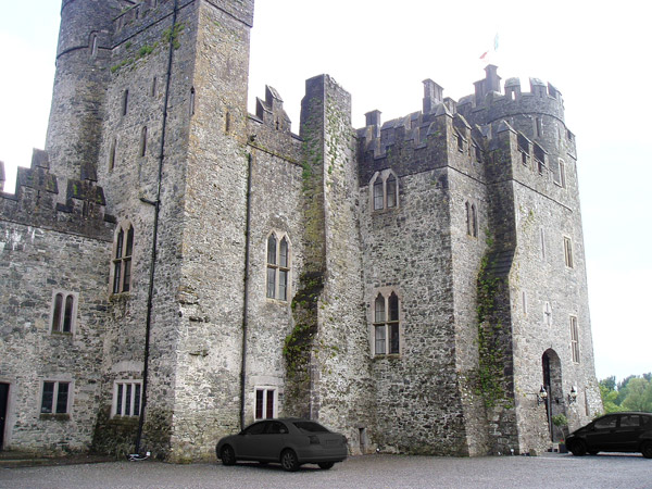
“Kilkea Castle Castledermot Ireland” by G.Smith -Wikimedia
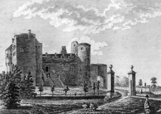
Kilkea Castle Co Kildare Ireland 1792 by Capt. Francis Grose – Wikimedia
The castle was built by the English Norman Hugh de Lacy in 1180, and later passed to the Fitzgeralds. Gerald FitzGerald, 11th Earl of Kildare, is said to have practised magic in Kilkea Castle which earned him the nickname “the Wizard Earl”.
The earliest known Irish Parliament met at Castledermot on 18 June 1264 and a structure known as the Parliament Building was located on the market square until the 18th century. Also, the oldest intact stone-work window in Western Europe can be found in the town, being part of the ruins of a Franciscan Monastery.
The River Lerr, a tributary of the River Barrow, the second longest river in Ireland, flows through the town. – Wikipedia
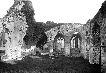
Franciscan Monastery – National Library of Ireland
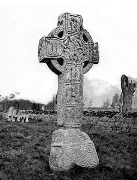
High Cross Castledermot – Natonal Library of Ireland
8. Athy or Baile Átha Í is named after a 2nd-century chieftain, Ae, who is said to have been killed on the river crossing, thus giving the town its name “the town of Ae’s ford”. The earliest maps show development on the river Barrow in the area, Ptolemy’s map of Ireland circa 150 AD clearly names the Rheban district as Rheba.

“Prima Europae tabula” by maps.bpl.org – Wikimedia
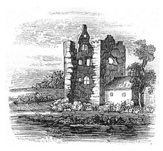
RHEBAN CASTLE, COUNTY KILDARE
The Illustrated Dublin Journal, Volume 1, Number 20, January 18, 1862
RHEBAN was, in the second century, one of the inland towns of Ireland. The castle stands on the western bank of the Al Berba, Birgus, or Barragh, (the boundary river,) now the river Barrow. It was built, or greatly enlarged, in the early part of the thirteenth century, by Richard de St. Michael, when this and Dunamase, an adjoining district, were erected into a barony. Rheban was found of consequence to the first English settlers, who repaired and strengthened the castle, as also the opposite one of Kilberry, both intended to protect a ford on the river. The name of this castle was anciently Raiba, or Righ-ban, that is, the habitation of the king; and though now in ruins, some idea can be formed of its former grandeur. Its massive walls, its mullioned windows, with its imposing situation, show it to be a place designed to awe the surrounding country, and forcibly call to mind the days when the chivalrous De St. Michael held his court here in feudal splendour, and lorded it over the petty chieftains of the borders of the Pale. The Pale from the Latin ‘Palus’ (stake used to support a fence) was the boundary between English occupied Ireland and the rest of the country. It was surrounded with a fence to keep out the Irish. The area within the Pale was considered to be cultured and respectable, English society dominated and the people behaved appropriately, following the rules of polite society. Outside the Pale things were not quite so ordered.This is where the phrase ‘Beyond the Pale’ comes from. – Library Ireland.
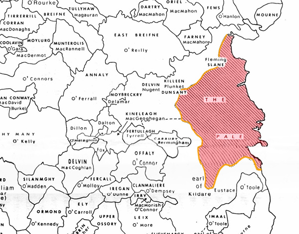
The Pale
9. Dunamase
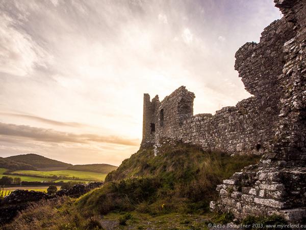
“Castle of Dunamase ” by Meinirland.eu – Wikimedia
The ruins of Dunamase Castle, a defensive stronghold dating from the early Anglo-Norman period with a view across to the Slieve Bloom Mountains. It is near the N80 road between the towns of Portlaoise and Stradbally. It was built in the second half of the 12th century.
10 : DUNAMASE and the O’MORES of LEIX
11. Stradbally: Stradbally is famous for its Steam Rally, an annual gathering of enthusiasts of steam-powered vehicles, held in the grounds of the Cosby estate at Stradbally Hall. Traction engines and other steam-powered vehicles are brought to the rally and displayed and demonstrated, and a steam railway offers rides along a short track which is a narrow guage line using locomotives called “Rusty”, “Nippy” and “No 2”. There is also a Steam Museum in Stradbally Town itself.
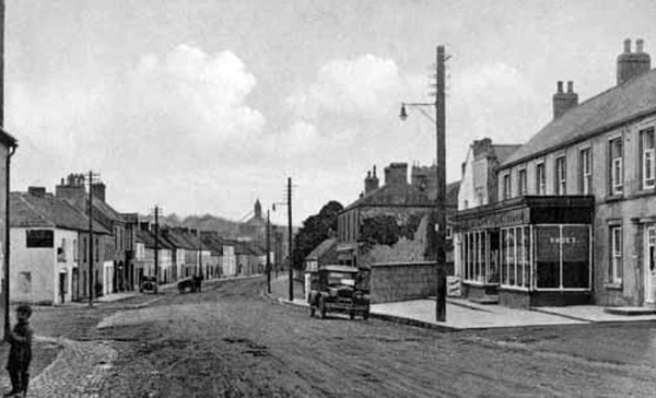
Stradbally circa 1900
- Comments(0)